
Hempstead ZIP Code Directory Coverage
Town of Hempstead is served or intersected by a wide group of postal areas. The table is a working service-area inventory based on official USPS city and ZIP material, Nassau municipality data, the Town map, and local government address use. Use the USPS ZIP Lookup and a parcel search to confirm a particular address. A postal label may cover only part of a place, and several listed areas sit near another Town, village, or city boundary.
| ZIP | Postal label | Town area commonly served or intersected | Local caution |
|---|---|---|---|
| 11001 | Floral Park | Floral Park portions in Hempstead | Village and Town boundary mismatch |
| 11003 | Elmont | Elmont and South Floral Park vicinity | Elmont special parking form uses this ZIP |
| 11010 | Franklin Square | Franklin Square | Postal label differs from Town jurisdiction |
| 11040 | New Hyde Park | New Hyde Park portions | Town, village, and school-district edge |
| 11096 | Inwood | Inwood and Five Towns area | Postal city and Town area differ |
| 11501 | Mineola | Small northern and central intersections | Mostly North Hempstead, verify parcel |
| 11509 | Atlantic Beach | Atlantic Beach and East Atlantic Beach | Coastal village and service area |
| 11510 | Baldwin | Baldwin and Baldwin Harbor | Standard local ZIP |
| 11514 | Carle Place | Carle Place edge | Mostly North Hempstead, possible Town intersection |
| 11516 | Cedarhurst | Cedarhurst | Village within the Town |
| 11518 | East Rockaway | East Rockaway and Bay Park vicinity | Village and hamlet overlap |
| 11520 | Freeport | Freeport | Incorporated village within the Town |
| 11530 | Garden City | Garden City and institutional edges | Postal label can cross a line |
| 11549 | Hempstead | Hofstra University delivery | Unique ZIP, not a general residential ZIP |
| 11550 | Hempstead | Village of Hempstead, South Hempstead, and nearby | Main Hempstead post office, not the whole Town |
| 11552 | West Hempstead | West Hempstead and Lakeview portions | Postal name differs from hamlet terms |
| 11553 | Uniondale | Uniondale | Standard local ZIP |
| 11554 | East Meadow | East Meadow | Town hamlet and school-district context |
| 11556 | Uniondale | Uniondale and central institutional edges | Several labels can appear for Uniondale |
| 11557 | Hewlett | Hewlett and Five Towns | Check the separate Hewlett villages |
| 11558 | Island Park | Island Park | Village and coastal geography |
| 11559 | Lawrence | Lawrence | Five Towns |
| 11561 | Long Beach | Island Park and Long Beach edge | Long Beach city is outside the Town |
| 11563 | Lynbrook | Lynbrook and North Lynbrook | Village and hamlet split |
| 11565 | Malverne | Malverne and North Malverne | Village and hamlet split |
| 11566 | Merrick | Merrick and North Merrick | Town hamlet |
| 11569 | Point Lookout | Point Lookout | USPS-derived inventory marks a PO Box designation |
| 11570 | Rockville Centre | Rockville Centre | Incorporated village within the Town |
| 11572 | Oceanside | Oceanside | Town hamlet |
| 11575 | Roosevelt | Roosevelt | Town hamlet |
| 11580 | Valley Stream | Valley Stream and North Valley Stream | Village and unincorporated crossovers |
| 11581 | Valley Stream | Valley Stream | More than one ZIP can serve a civil area |
| 11590 | Westbury | Salisbury and South Westbury edge | Mostly outside the Town, verify parcel |
| 11598 | Woodmere | Woodmere and North Woodmere | Five Towns |
| 11599 | Garden City | Institutional delivery area | Verify address mode, not a blanket Town ZIP |
| 11702 | Babylon | Southern and eastern Town border | Town, Oyster Bay, and Babylon ambiguity |
| 11710 | Bellmore | Bellmore | Town hamlet |
| 11714 | Bethpage | Bethpage border | Split between Hempstead and Oyster Bay |
| 11756 | Levittown | Levittown | School-district boundary matters |
| 11758 | Massapequa | Massapequa edge | Mostly Oyster Bay, verify parcel |
| 11783 | Seaford | Seaford | Town hamlet |
| 11793 | Wantagh | Wantagh and North Wantagh | Town hamlet |
| 11801 | Hicksville | Northern and eastern edge | Mostly Oyster Bay, verify parcel |
The row for 11550 is especially easy to overread. It is a main Hempstead post-office label, not a label for the entire Town. Institutional ZIPs such as 11549 and 11599 also need an address-mode check before they are treated as general delivery areas.
Hempstead Postal Geography
The Town is not a postal city. A single record may use Town of Hempstead, a Village of Garden City or Uniondale description, a postal city, a ZIP, and a Nassau Section, Block, Lot at the same time. Each system has its own purpose. A ZIP code label organizes delivery. The assessment roll keys on the property’s situs and SBL. Recorded deeds rely on a legal description. Voter registration uses the registrant’s supplied residence, while an older directory preserves the address as it was printed.
The official Town map reports about 142 square miles, 34 unincorporated areas, 22 incorporated villages, and coastal as well as central Long Island geography. That scale is why a ZIP result must be paired with parcel geography. The map can also identify a political unit, road responsibility, and a hamlet or village boundary.
The Nassau parcel map is a useful second check after a postal lookup. Its parcel and layer view can show the lot’s location, historic map context, and nearby boundaries, but it should not be used to infer who occupies a property.
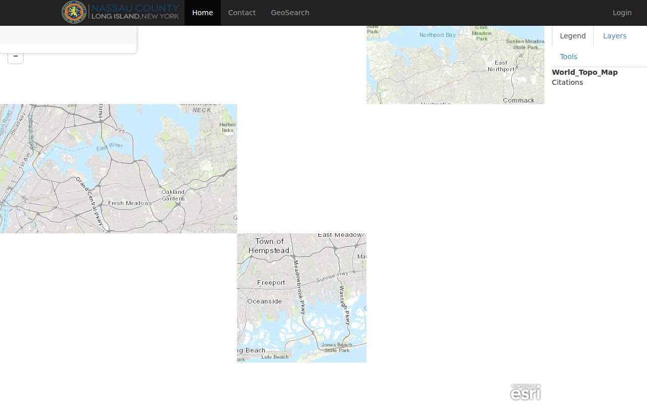
Read the GIS popup with the assessment detail rather than relying on its visual position alone. Parcel boundaries are confirmed through official tax maps and deeds.
USPS Checks for Hempstead ZIPs
USPS offers three useful checks. Address mode standardizes a specific mailing address. City and state mode returns ZIPs associated with a mailing city. ZIP-to-city mode lists the cities associated with a ZIP. Use the official USPS lookup before entering a ZIP in a county portal, especially when an address has a village, hamlet, or neighboring-city label.
USPS warns that a postal result does not confirm that a person or company is at an address. That is an important limit for any ZIP search. A ZIP code result confirms a delivery format, not occupancy. Compare it with the parcel record for property context, and use an identity-specific public record only within that record’s own rules.
Postal result, not resident proof. A Hempstead ZIP can help normalize an address, but it cannot establish who lives there or disclose a complete household.
Search Hempstead by ZIP
A ZIP narrows a local search but does not create a Town-wide resident browse. The most reliable process uses the postal check to normalize an address, then switches to the record system that matches the question. Nassau LRV and AROW accept ZIP in address searching. The voter portal displays ZIP within an identity-specific form, while the state licensee search uses ZIP only as a narrowing field. The public GIS inventory did not expose a simple full-ZIP browse, so verify each parcel by address.
- Use USPS address mode to confirm the normalized delivery form.
- Enter the house number, street, Town, and ZIP in LRV or use the AROW address form. Keep the returned SBL or parcel identifier.
- Open the parcel detail and map to check situs, district, and local geography.
- When the result narrows to a named street, use the Hempstead street directory for the parcel, deed, and historic-record trail.
New York’s voter lookup is not a ZIP-wide list. It requires county, first and last name, date of birth, address information, and displays ZIP as part of the registration search. A full voter-data request has an elections-purpose statement requirement under Election Law §3-103(5) and use restrictions.
Hempstead ZIP Search Fields
The LRV’s address form exposes ZIP beside the house number, street, and Town. AROW treats ZIP as required for its address search and recommends a street-name-only approach when appropriate. The table separates these ZIP-capable modes so a narrow field is not mistaken for a resident list.
| Record system | ZIP role | Other fields or limit |
|---|---|---|
| Nassau LRV | Address-search field | Used with house number, street, Town, or SBL context |
| Nassau AROW | Required address-search field | Address or SBL search; tips recommend street-name-only searches |
| NYS voter lookup | Displayed with registration search | Requires name, date of birth, county, and address details |
| NYS licensee search | Narrowing field | Used with a public license query, not a general address roll |
| DCJS public directory | Search option | Has statutory coverage and publication limits |
The Nassau LRV search form shown below illustrates the parcel-focused search. Its result is a property-record lead, and recorded ownership should be verified through the Clerk’s documents when title matters.
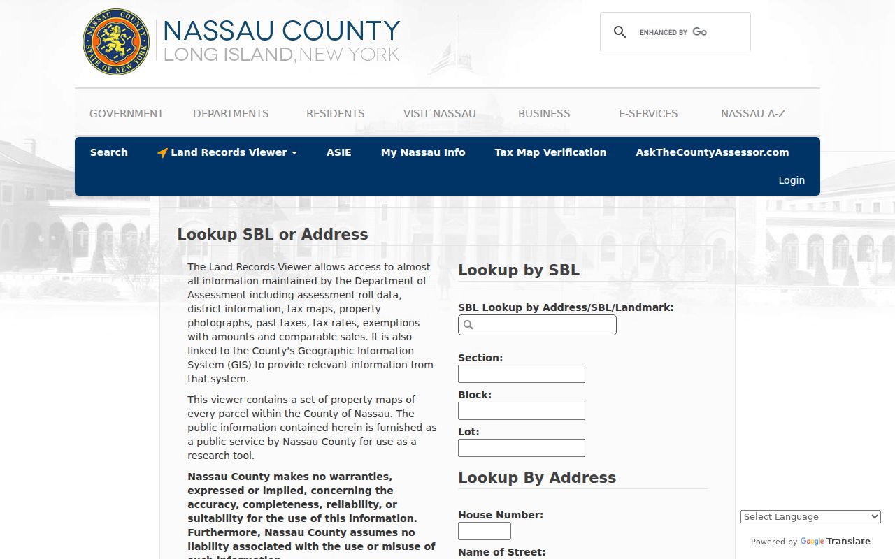
Store the returned parcel information with the postal result. That makes it possible to reconcile a mailing label with the correct situs and legal description.
Uniondale’s Hempstead ZIP Puzzle
Uniondale is a clear example of why the postal label should not be treated as a municipal line. The research inventory lists 11553 for Uniondale and identifies 11556 as Uniondale and central institutional edges. It also notes that Uniondale can appear split among 11553, 11555, 11556, and neighboring mailing labels. At different edges, addresses may be associated with Hempstead, Garden City, or Westbury postal wording.
Start with the exact address in USPS, then compare it with the Nassau parcel record and the Town map. Keep the village, hamlet, school-district, and SBL information with the search notes. This avoids a false match created by a familiar place name or by a postal city that crosses a boundary.
Coastal Hempstead ZIP Edges
Coastal labels need the same careful check. Atlantic Beach and East Atlantic Beach use 11509 in the service-area inventory. Island Park appears under 11558, while the 11561 Long Beach label can touch Island Park even though the City of Long Beach is outside the Town. Point Lookout’s 11569 is noted as a PO Box designation in the USPS-derived inventory, so delivery type should be confirmed. Oceanside, Hewlett, Lawrence, and the Five Towns bring additional coastal and village context.
For a coastal parcel, the address record can also connect to a dated waterways permit. From January 24, 2025, the Town’s structures-in-waterways permit process uses OpenGov for work such as bulkheads. That file can describe a parcel change, but it does not settle a postal or title question by itself.
Hempstead ZIPs and Parcel Keys
When a ZIP produces an address result, the next reliable key is the Nassau parcel identifier. Record the situs address and SBL from LRV, then compare them with the legal description in the deed index. Nassau warns that its assessment and Clerk databases use different SBL placeholders. The values need reconciliation rather than a simple copy from one screen to another.
The Nassau GIS parcel layer exposes fields including PARCEL, PARCELKEY, PARID, PARCEL_ADDRESS, ROLL_YEAR, geometry, and map measurements. It supports query and pagination, but the public layer is not a substitute for official parcel detail. Parcel-level checking is the appropriate next step when a ZIP has narrowed the search area.
Note: A postal label can change the words printed on an address while the legal description and parcel identity remain the stronger continuity markers.
Limits of Hempstead ZIP Boundaries
A ZIP is a delivery geography, not a Town, village, or ownership boundary. It can support address normalization and a local search filter, but it cannot prove residence or establish a full set of occupants. Records also change at different times. USPS manages delivery designations, while the assessment roll, deed record, voter record, and older directory use different keys and update cycles.
- ZIP plus four
- An added delivery segment after the five-digit ZIP that helps USPS sort mail more precisely.
- PO Box ZIP
- A postal designation used for box delivery. It may not describe a general street-delivery area.
- Unique ZIP
- A ZIP assigned for a particular institution or delivery purpose, not a blanket label for nearby addresses.
- Carrier route
- A postal delivery grouping used to organize mail service, not a civil boundary or parcel line.
No official source inspected documented a Town-wide historical ZIP split or realignment year. Confirm an old postal question through USPS or Nassau GIS archival material rather than assigning a date that has not been published. Protected addresses remain protected even when a matching postal label appears elsewhere in public records.